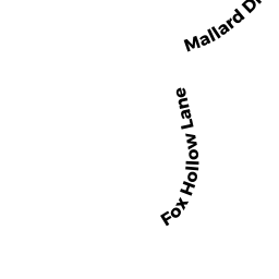
34 MALLARD DR
Owner Information
SMILY, TERRENCE D.
34 MALLARD DR
SHARON, MA 02067


Property Details
34 MALLARD DR is classified as a Single Family Residential (Colonial).
The primary structure on this property was built in 1970. There are 5,454ft2 of built area within this property. There is 3,066ft2 of residential/living space within this property. This property is listed as having 9 rooms.
34 MALLARD DR is valued at $722,500. The land is valued at $346,900 and the structures are valued at $372,600. There is an additional valuation of $3,000 on this property.
The most recent deed for 34 MALLARD DR is recorded at the local registrar in Book LC193991, Page 0. 34 MALLARD DR was last sold on Friday, August 26, 2016 for $705,000.
Assessment data from fiscal year 2022.
Flood Data
According to the FEMA National Flood Hazard Layer, this property does not appear to be in a flood zone. It may also be in an area not yet reviewed. Nonetheless, confirm this information prior to taking any action.
To view the flood hazards around this property, create a FEMA "Firmette" Map of the area around 34 MALLARD DR.
Broadband Internet Providers
| Provider | Type | Bandwidth (mbps) | |
|---|---|---|---|
| VSAT Systems, LLC. | Satellite | 2 | 1 |
| Viasat Inc | Satellite | 100 | 3 |
| Verizon New England Inc. | DSL | 7 | 0 |
| Comcast | Cable | 1000 | 35 |
| GCI Communication Corp. | Satellite | 0 | 0 |
| HughesNet | Satellite | 25 | 3 |
Broadband service provider data from December 2020.
Adjacent Properties
- 9 FOX HOLLOW LN
Single Family Residential owned by SHIKORA, SCOTT A. - 17 WEST RIDGE DR
Single Family Residential owned by SMIRNOV, STANISLAV - 38 MALLARD DR
Single Family Residential owned by VILLAROEL, JESSE - 5 FOX HOLLOW LN
Single Family Residential owned by ANDRADE, CARLOS P. - 30 MALLARD DR
Single Family Residential owned by HANNA, RICHARD T. JR.